mikesusamoments.com
DE EN

Utah

Bryce Canyon

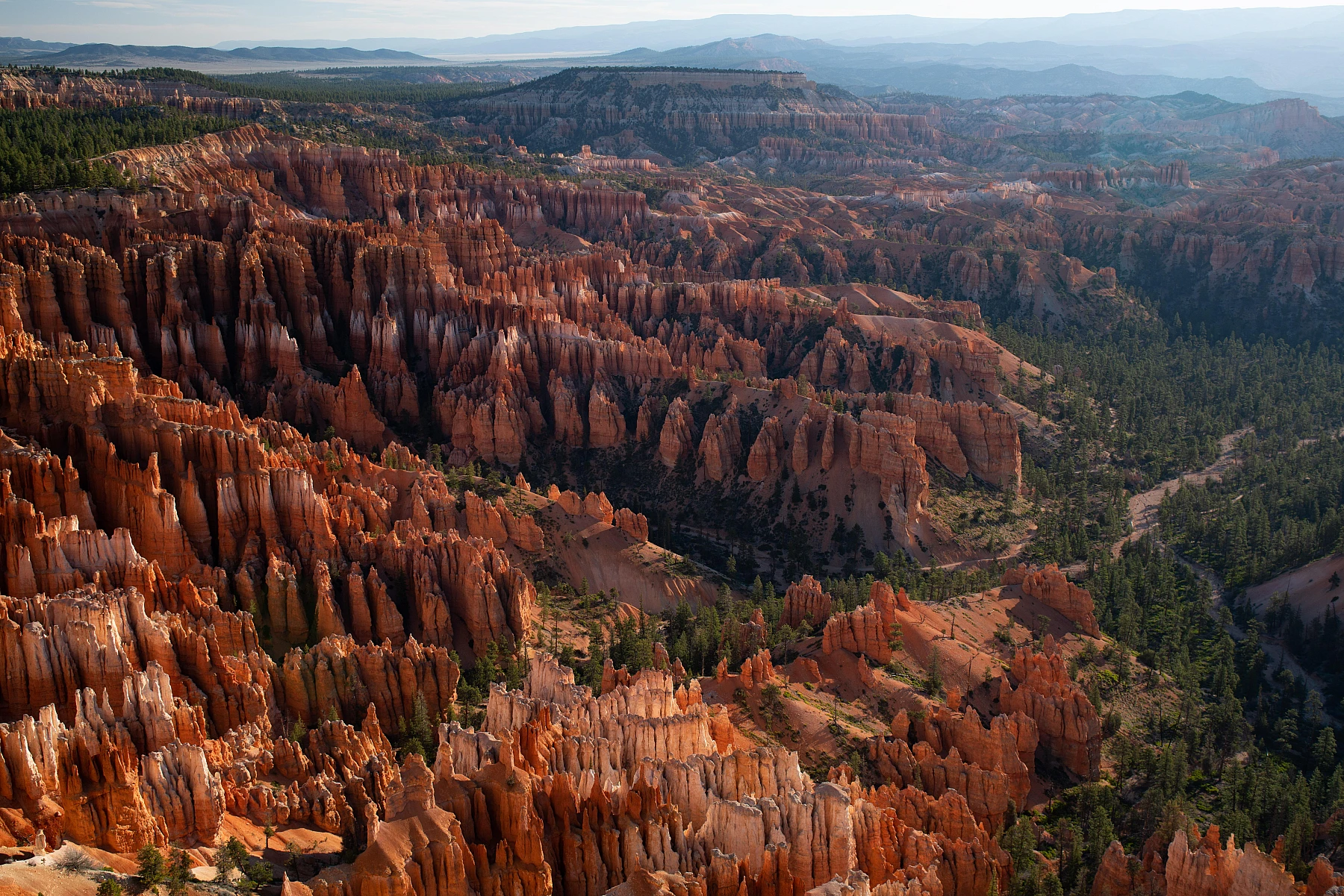
A forest of orange stone pillars, many find it more beautiful than its big brother.

StateUtah
Park since1928
Size56 sq mi (145 km²)
Entrance feeabout 35 USD per vehicle (7 days), since 2026 non-residents pay an extra 100 USD per person
Time to planOne day for the highlights, two with a hike.

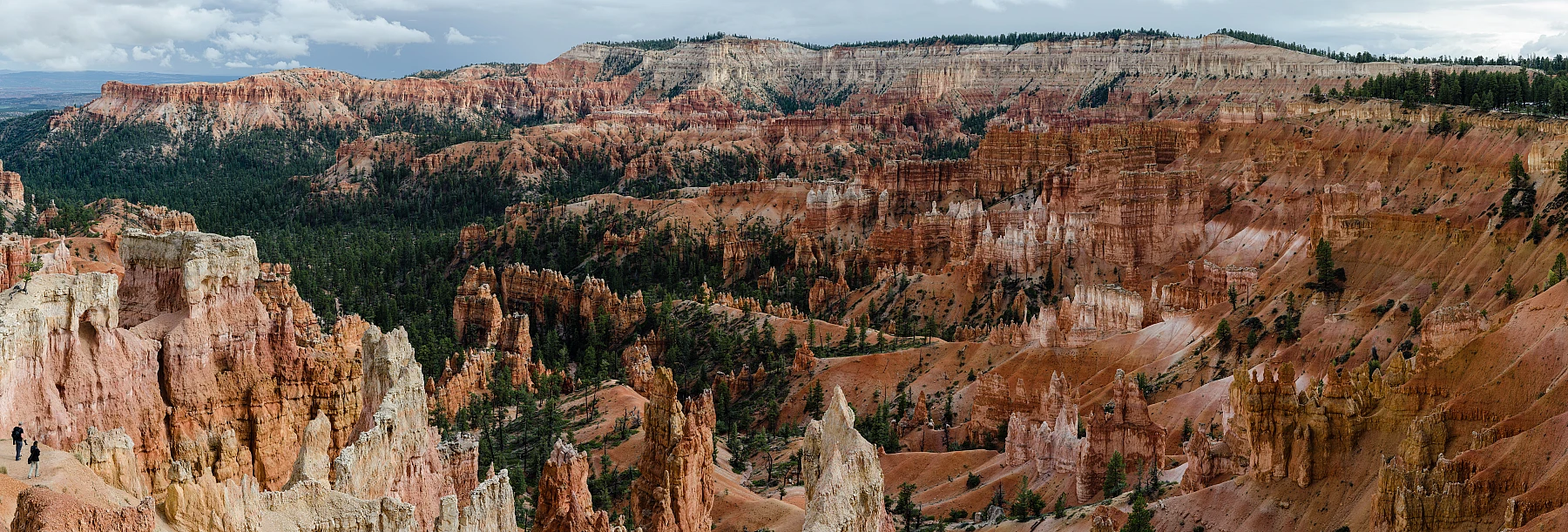
Bryce Canyon is not really a canyon at all, but a series of natural amphitheaters full of hoodoos, those thin, orange-red stone pillars. Many come straight from the Grand Canyon and are surprised that they like the smaller Bryce even more.

Thousands of hoodoos, shaped by frost and water over thousands of years.

A forest of stone pillars

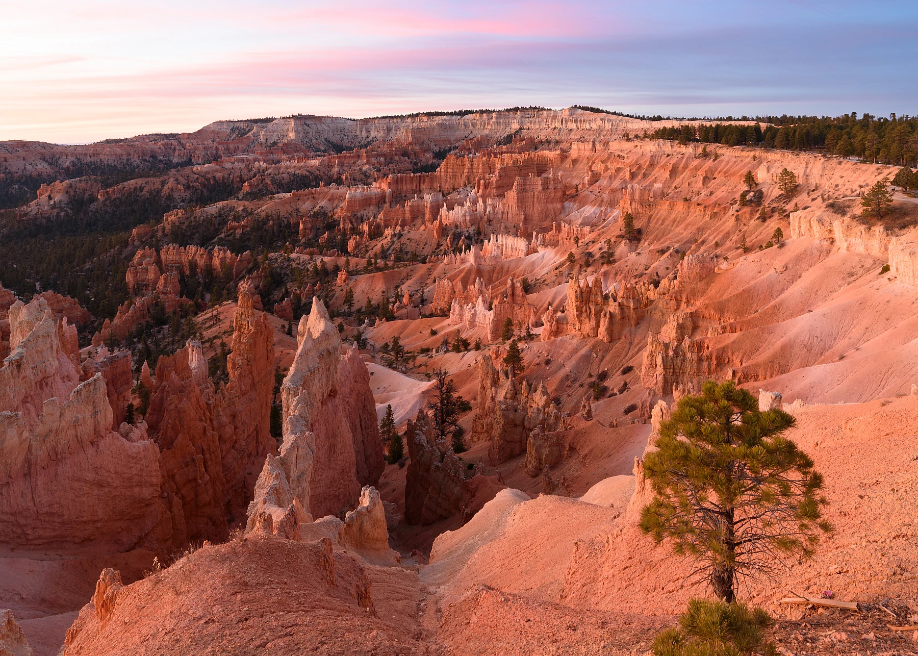
Thousands of hoodoos stand densely packed in the great amphitheater. They form because the frost splits the rock apart winter after winter and washes the softer stone away. At sunrise they glow in orange and pink, the most beautiful moment of the day.

High up and cool

Bryce lies high, on the rim at around 7,875 to 8,860 ft (2,400 to 2,700 m). Because of that it is pleasant even in high summer, and in winter snow often lies on the red pillars, a striking contrast. Do not underestimate the altitude, though, even a short climb becomes strenuous here.

First from above, then from below

From the Rim Trail on the edge you have the overview of the whole amphitheater. But you only really get close to the pillars once you go down, for example along the Navajo Loop. Suddenly you stand among them, and they tower above you.

Early is worth it

The park is smaller and busier than you think. Whoever stands at Sunrise or Sunset Point early for sunrise has the best light and the greatest calm.

Top viewpoints

What you shouldn't miss.

Sunrise Point, Bryce Canyon
1

Sunrise Point

The classic spot for sunrise. When the first rays hit the hoodoos, the whole amphitheater glows.

Directions with Google Maps
Sunset Point, Bryce Canyon
2

Sunset Point

Despite the name, great during the day too and the starting point of the Navajo Loop. From here you can see Thor's Hammer.

Directions with Google Maps
Inspiration Point, Bryce Canyon
3

Inspiration Point

The widest view over the entire amphitheater, reachable on several levels. Many stay only at Sunset Point and miss it.

Directions with Google Maps
Navajo Loop Trail, Bryce Canyon
4

Navajo Loop Trail

The famous descent in tight switchbacks, past Thor's Hammer and the high walls of Wall Street.

Directions with Google Maps

The big questions from the forum

What was discussed most on USA-TALK.DE, with the community verdict.

Bryce or Grand Canyon, which is more beautiful?

A real point of contention in the forum. Many find Bryce with its hoodoos even more impressive and more personal than the sheer vastness of the Grand Canyon. The conclusion almost always: two completely different experiences, both worth it.

Is one day enough?

For the viewpoints and a hike like Queens Garden plus Navajo Loop one day is plenty. Anyone who wants to catch sunrise and sunset plans an overnight stay.

Is getting up early for sunrise worth it?

Clearly yes. When the first rays hit the hoodoos, the whole amphitheater glows. That is exactly why many come a second time.

Does Bryce still make an impression after the Grand Canyon?

It comes up again and again in the forum, and the majority clearly disagrees. Bryce is not comparable to the Grand Canyon at all. Where the Grand Canyon impresses through its size but offers similar views from the viewpoints, Bryce scores with color and the variety of hoodoo formations, into which you can also easily walk. Some voices even put Bryce at the top of their ranking of the parks.

Practical tips from the forum

Concrete advice from travellers who were there.

You're best off watching sunrise at Bryce from Sunset Point, not Sunrise Point. It sounds backwards, but by comparison it really is the better spot. You can get the exact time at the Visitor Center.

from the USA-TALK.DE forum

If you're short on time, the nicest short loop runs from Sunset Point down the Navajo Trail and along the Queens Garden Trail to Sunrise Point, then back along the Rim Trail. Count on an hour and a half to two hours.

from the USA-TALK.DE forum

Arrive as early in the day as you can, ideally around midday. Then you can see all the viewpoints and still take a walk down into the canyon without rushing. If you don't roll in until four thirty in the afternoon and drive on the next day, you'll barely see anything, because it gets dark earlier in the US.

from the USA-TALK.DE forum

On the drive between Page and Bryce, it's worth a stop at the Toadstool Hoodoos just past milemarker 19 on Highway 89. From the little parking lot you walk about 15 to 20 minutes through a dry riverbed, and then you're standing in front of gorgeous rock formations that are still lit by the sun even in the afternoon.

from the USA-TALK.DE forum

Voices from the community

What travellers experienced on the spot.

We came straight from the Grand Canyon and thought it could not get any better. Bryce then completely blew us away.

from the forum USA-TALK.DE

The Navajo Loop is a must. From the rim you have no idea how tall the pillars really are until you stand among them at the bottom.

from the forum USA-TALK.DE

In September it was really cold up there in the mornings, do not forget a hat. But the sunrise was worth every degree of frost.

from the forum USA-TALK.DE

Bryce already impresses with its color, red in the most varied shades. At the viewpoints there are countless shapes and rock formations, and you can easily walk a bit into the canyon. Anyone who claims you do not need Bryce after the Grand Canyon might as well skip Zion too.

from the forum USA-TALK.DE

From Sunset Point I walked down the Navajo Trail and back to Sunrise Point via Queens Garden, then back along the Rim Trail. An hour and a half to two hours, and it is absolutely worth it. Queens Garden in particular is incredible, you have to see it once.

from the forum USA-TALK.DE

I can highly recommend the Navajo Loop, but only as a warning if it has rained or is raining. The paths are then as slippery as soft soap and there are no railings. I got to test that myself, on the way up whole tour groups turned back because it was too slippery for them.

from the forum USA-TALK.DE

On the drive towards Bryce the roads were lined left and right by high, red to yellow rock walls, and in the distance the red stone was already glowing. Just driving through this area was sensational.

from the forum USA-TALK.DE

You must not underestimate how long the park actually is. Only Sunset and Sunrise Point lie close together, the other points are a good way off, and you have to drive the stretch back, because you cannot drive straight through Bryce like Zion or the Grand Canyon.

from the forum USA-TALK.DE

Have you been here? Share your impression

Your experience helps other travellers more than any glossy brochure. Every post is briefly reviewed before publication.

Stay fair and on topic. I approve posts that help others.

Climate through the year

Average temperatures, day and night. Large value °C, small value °F.

36°F-12°10°F
Jan
39°F-11°12°F
Feb
46°F-7°19°F
Mar
12°54°F-4°25°F
Apr
17°63°F32°F
May
23°73°F39°F
Jun
26°79°F46°F
Jul
24°75°F45°F
Aug
20°68°F37°F
Sep
14°57°F-2°28°F
Oct
45°F-7°19°F
Nov
37°F-11°12°F
Dec

Map with viewpoints

Park, entrances and the best viewpoints at a glance.

Loading the map transfers data (including your IP address) to OpenStreetMap.

Official park map

The official National Park Service map. Zoom and pan.

Map: National Park Service, public domain.

Open map as PDF

Trails at a glance

From a short loop to a full-day hike.

TrailLengthDurationDifficultyNote
Rim Trail5.3 mi (8.5 km)flexibleeasyLevel along the rim between the viewpoints, good at any time and with a constant view into the amphitheater.
Navajo Loop1.4 mi (2.2 km)1 to 2 hrsmoderateThe classic descent through Wall Street, past Thor's Hammer. The way back is steep.
Queens Garden + Navajo Loop3.1 mi (5 km)2 to 3 hrsmoderateThe most popular combination: gently down via Queens Garden, more steeply back up via the Navajo Loop.
Peekaboo Loop5.5 mi (8.8 km)3 to 4 hrshardLonger and quieter, right through the hoodoos. Also used by riders.

Distances and driving times

How far it is to the key places nearby.

FromDistanceDrive time
Zion National Park80 mi (125 km)approx. 1.5 hrs
Grand Canyon (North Rim)160 mi (260 km)approx. 2.5 hrs
Capitol Reef110 mi (180 km)approx. 2 hrs
Las Vegas260 mi (420 km)approx. 4 hrs
Salt Lake City265 mi (430 km)approx. 4 hrs

Where to stay

Right in the middle of things, or cheaper a bit further out.

Bryce Canyon Lodge

in the park

Historic lodge from 1925, right at the amphitheater. Very sought after, book months in advance, open only in summer.

Ruby's Inn

right at the park entrance

A large, well-known place just outside the park, with everything around it. Easier to get.

Tropic and Bryce Canyon City

a few minutes away

Small towns with further motels and lodges, often cheaper than in the park.

Insider tips and common mistakes

What was worth it and what to skip.

Insider tips

  • Walk down Queens Garden and up the Navajo Loop, that way the steep part is a short one on the ascent.
  • Inspiration Point for the widest view, there are fewer people there than at Sunset Point.
  • Stay in the evening: Bryce has one of the darkest night skies in the USA, with ranger astronomy programs.

Common mistakes

  • Staying only at the rim. The real magic only comes on the descent among the hoodoos.
  • Underestimating the altitude. Above 8,860 ft (2,700 m) even a short climb becomes strenuous.
  • Dressing too lightly in summer. In the mornings at the rim it is often bitingly cool.

Photos

Click to enlarge.

Bryce Canyon Bryce Canyon Bryce Canyon

Videos

The video loads from YouTube only when you click. No data flows before that.

Bryce Canyon, 4K Scenic Guide

Watch on YouTube ↗

Bryce Canyon, Ultimate Travel Guide

Watch on YouTube ↗

Bryce Canyon in Winter, Tips

Watch on YouTube ↗

Bryce Canyon, Hoodoos and Tips

Watch on YouTube ↗

Frequently asked questions

How much time should I plan?

One day is enough for the viewpoints and a hike. With sunrise and sunset an overnight stay is worth it.

Which hike is most worthwhile?

The combination of Queens Garden and Navajo Loop, around five kilometers, leads right through the hoodoos and is considered the most beautiful.

When is the best time to travel?

Late spring to autumn. In winter it is snowy and especially photogenic, but cold and partly restricted.

What does admission cost?

Around 35 USD per vehicle for seven days, or covered by the America the Beautiful pass.

Nearby

Easy to combine on a road trip.

Head to head

Hard to decide? This comparison helps.

Share

Last checked . I check changeable details like entrance fees once a year.