mikesusamoments.com
DE EN

Utah

Capitol Reef Nationalpark

Red cliffs, historic orchards and barely any crowds.

StateUtah
Park since1971
Size380 sq mi (979 km²)
Entrance feea small fee for the Scenic Drive, covered by the America the Beautiful pass
Time to planHalf a day to a full day.

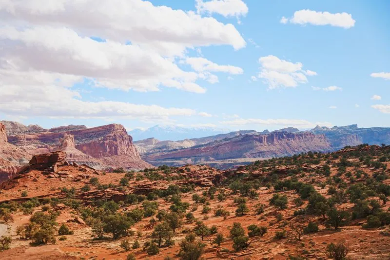
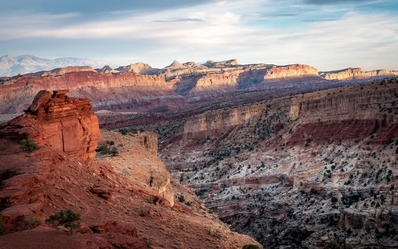
Capitol Reef is the quietest of the five Utah parks. While the crowds throng at Zion and Arches, here you have much of it almost to yourself. Right through the landscape runs the Waterpocket Fold, a nearly hundred-kilometer-long fold in the earth's crust, plus red rock walls and, in the middle of it, green orchards.
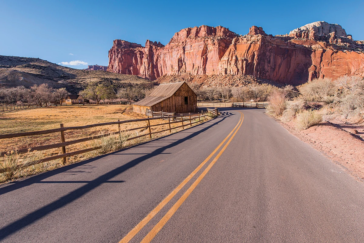
Glowing red rock walls and hardly a soul, that is Capitol Reef.

Fruita and the orchards

Right in the middle of the park lies the historic settlement of Fruita with its old orchards. In harvest season you may pick your own apples, pears or cherries there, a tradition from pioneer times. A picnic under the trees, red rocks all around, you get that only here.

The Scenic Drive

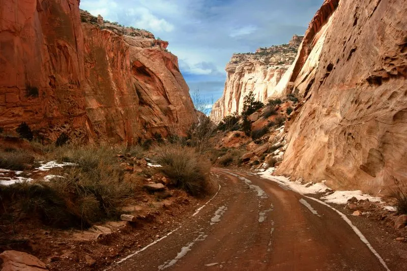
From the visitor center the Scenic Drive leads around eleven kilometers along high rock walls, with turn-offs into narrow gorges like the Capitol Gorge. A quiet stretch that shows a lot even without a big hike.

The journey there is already an experience

Many come over the Scenic Byway 12 from Bryce, named again and again in the forum as one of the most beautiful roads in the Southwest. The drive to Torrey, the town at the park entrance, is worth it in itself.

When you should come

Spring and autumn are ideal, in autumn the harvest is added. Summer is hot, winter quiet and often with snow on the heights.

Top viewpoints

What you shouldn't miss.

The Scenic Drive, Capitol Reef Nationalpark
1

The Scenic Drive

Eleven kilometers along mighty red walls, with detours into narrow gorges. Impressive even without a hike.

Directions with Google Maps
Cassidy Arch, Capitol Reef Nationalpark
2

Cassidy Arch

A mighty stone arch you can even walk across. Named after the outlaw Butch Cassidy.

Directions with Google Maps
Capitol Gorge, Capitol Reef Nationalpark
3

Capitol Gorge

A narrow gorge at the end of the Scenic Drive, once the only through route, with old inscriptions on the walls.

Directions with Google Maps
Hickman Bridge, Capitol Reef Nationalpark
4

Hickman Bridge

An easy hike to a natural stone bridge, one of the most beautiful short trails in the park.

Directions with Google Maps

The big questions from the forum

What was discussed most on USA-TALK.DE, with the community verdict.

Is Capitol Reef worth it alongside the other parks?

Surprisingly unanimous yes in the forum. Precisely because it is quieter, it stays strongest in many people's memory. Anyone who just drives through misses something.

Scenic Byway 12, really that beautiful?

Clearly. The road from Bryce to Torrey is considered in the forum one of the most beautiful in the whole Southwest, the drive alone is a highlight.

Is the Scenic Drive enough or is a hike worth it?

The Scenic Drive alone is already strong. Anyone with time takes in the Hickman Bridge or the Cassidy Arch, both short and rewarding.

Practical tips from the forum

Concrete advice from travellers who were there.

The Fruita Campground is the only developed campground in the park and can't be reserved, it's first come, first served. On busy days it's often full by early to mid afternoon, so be there by early morning at the latest, especially on weekends.

from the USA-TALK.DE forum

Even if you're not planning an overnight stop, take a break in Fruita at the picnic area by the Visitor Center. Stock up on picnic supplies at the supermarket in Moab in the morning, and then it's perfect for the green lawn under the trees.

from the USA-TALK.DE forum

You don't need to plan around Capitol Reef separately anyway, the park sits right between Escalante and Moab on Scenic Highway 12. Detouring to the interstate would be silly, the drive through itself is very pretty.

from the USA-TALK.DE forum

For a quick overview, turn off onto the Scenic Drive at the Visitor Center and drive a stretch of it, out to Panorama Point. On Highway 12 you'll have one great view after another anyway.

from the USA-TALK.DE forum

Voices from the community

What travellers experienced on the spot.

The road from Bryce to Capitol Reef over the Scenic Byway 12 was for us one of the most beautiful of the whole trip. It is worth the detour for that alone.

from the forum USA-TALK.DE

In Fruita we took a break under the fruit trees, red rocks all around, hardly a soul. We had such a quiet moment nowhere else.

from the forum USA-TALK.DE

Capitol Reef was our secret favorite. No crowds, and yet a really grand landscape.

from the forum USA-TALK.DE

Capitol Reef is a very photogenic park, even if you only drive through. In Fruita near the visitor center you can picnic wonderfully on green meadows among deer and fruit trees, at the confluence of Sulphur Creek and the Fremont River.

from the forum USA-TALK.DE

The Fruita Campground is one of the most beautiful we have driven to. Lush green meadows, many fruit trees, plenty of deer, and the magnificent panorama of Capitol Reef on top of it. A green oasis in the middle of the red rock landscape, especially beautiful in the late afternoon, when the day visitors have gone.

from the forum USA-TALK.DE

My tip is to drive the Scenic Drive to the very end and then turn left onto the unpaved road. The narrow gorges you have to pass through are breathtaking. At the end you park and follow the riverbed on foot, a very beautiful path, cars even used to drive through here, hard to imagine.

from the forum USA-TALK.DE

The backcountry of Capitol Reef is worthwhile too. Over the Notom Road and the western part of the Burr Trail Scenic Byway you get around wonderfully, without missing the most interesting stretches of the 12. Even with just half a day extra you get to see quite a bit here.

from the forum USA-TALK.DE

It is nice to come here before Bryce. Once you have digested Bryce, hardly anything knocks your socks off any more, because Bryce is for me the most beautiful thing I have seen. In the other order Capitol Reef comes into its own better.

from the forum USA-TALK.DE

Have you been here? Share your impression

Your experience helps other travellers more than any glossy brochure. Every post is briefly reviewed before publication.

Stay fair and on topic. I approve posts that help others.

Climate through the year

Average temperatures, day and night. Large value °C, small value °F.

45°F-7°19°F
Jan
11°52°F-4°25°F
Feb
16°61°F-1°30°F
Mar
21°70°F37°F
Apr
27°81°F46°F
May
33°91°F13°55°F
Jun
36°97°F17°63°F
Jul
34°93°F16°61°F
Aug
29°84°F11°52°F
Sep
22°72°F39°F
Oct
13°55°F-2°28°F
Nov
45°F-6°21°F
Dec

Map with viewpoints

Park, entrances and the best viewpoints at a glance.

Loading the map transfers data (including your IP address) to OpenStreetMap.

Official park map

The official National Park Service map. Zoom and pan.

Map: National Park Service, public domain.

Open map as PDF

Trails at a glance

From a short loop to a full-day hike.

TrailLengthDurationDifficultyNote
Hickman Bridge1.9 mi (3 km)1.5 hrseasy to moderateUp to the natural stone bridge, with a lovely view. The most popular short trail.
Cassidy Arch3.1 mi (5 km)2 to 3 hrsmoderateUp to the arch you can actually walk across. A little exposed at the end.
Capitol Gorge1.2 mi (2 km)1 hreasyLevel through the narrow gorge, past old inscriptions in the Pioneer Register.
Grand Wash4.3 mi (7 km)2 to 3 hrseasyLevel through a wide gorge with high walls, shady and quiet.

Distances and driving times

How far it is to the key places nearby.

FromDistanceDrive time
Bryce Canyon (via Byway 12)110 mi (180 km)approx. 2 hrs
Moab (Arches/Canyonlands)145 mi (230 km)approx. 2.5 hrs
Zion170 mi (270 km)approx. 3 hrs
Salt Lake City215 mi (350 km)approx. 3.5 hrs

Where to stay

Right in the middle of things, or cheaper a bit further out.

Torrey

at the west entrance

The nearest town, small hotels and lodges, cosy and close to the park.

Capitol Reef Resort

at the park entrance

Right outside the park, with a view of the red rocks.

Fruita Campground

in the park

A lovely campground right among the orchards, very popular.

Insider tips and common mistakes

What was worth it and what to skip.

Insider tips

  • In harvest season (usually late summer to autumn) pick your own in the orchards of Fruita, a small fee, a great experience.
  • Plan the Scenic Byway 12 from Bryce as part of the experience, not just as the drive there.
  • In the late afternoon the rock walls glow most beautifully, and that is also when the photos are best.

Common mistakes

  • Ticking Capitol Reef off as just a drive-through. Plan at least half a day.
  • Underestimating the altitude and the heat. There is little shade on the trails, take enough water.
  • Driving the narrow Capitol Gorge in the rain, flash floods are a danger there.

Photos

Click to enlarge.

Capitol Reef Nationalpark Capitol Reef Nationalpark Capitol Reef Nationalpark

Videos

The video loads from YouTube only when you click. No data flows before that.

Capitol Reef in One Day, 4K

Watch on YouTube ↗

Capitol Reef, the Travel Guide

Watch on YouTube ↗

Capitol Reef in 4K Ultra HD

Watch on YouTube ↗

Capitol Reef, Travel Guide

Watch on YouTube ↗

Frequently asked questions

Is Capitol Reef really worth it?

Yes, precisely because it is quieter than Zion or Arches. Many call it their secret favorite.

Can you really pick fruit in Fruita?

Yes, in harvest season you may pick your own in the historic orchards for a small fee.

How much time should I plan?

Half a day to a full day is enough for the Scenic Drive and a short hike.

What does admission cost?

The Scenic Drive costs a small fee per vehicle, or is covered by the America the Beautiful pass.

Nearby

Easy to combine on a road trip.

Share

Last checked . I check changeable details like entrance fees once a year.