mikesusamoments.com
DE EN

Utah

Zion Nationalpark

Sheer red walls, a green valley and the river running through it.

StateUtah
Park since1919
Size230 sq mi (593 km²)
Entrance feeabout 35 USD per vehicle (7 days), since 2026 non-residents pay an extra 100 USD per person
Time to planOne to two full days.

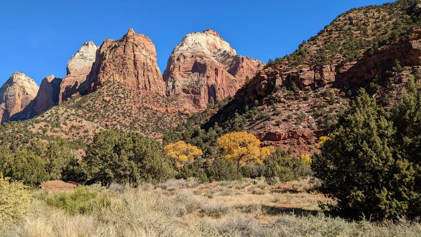
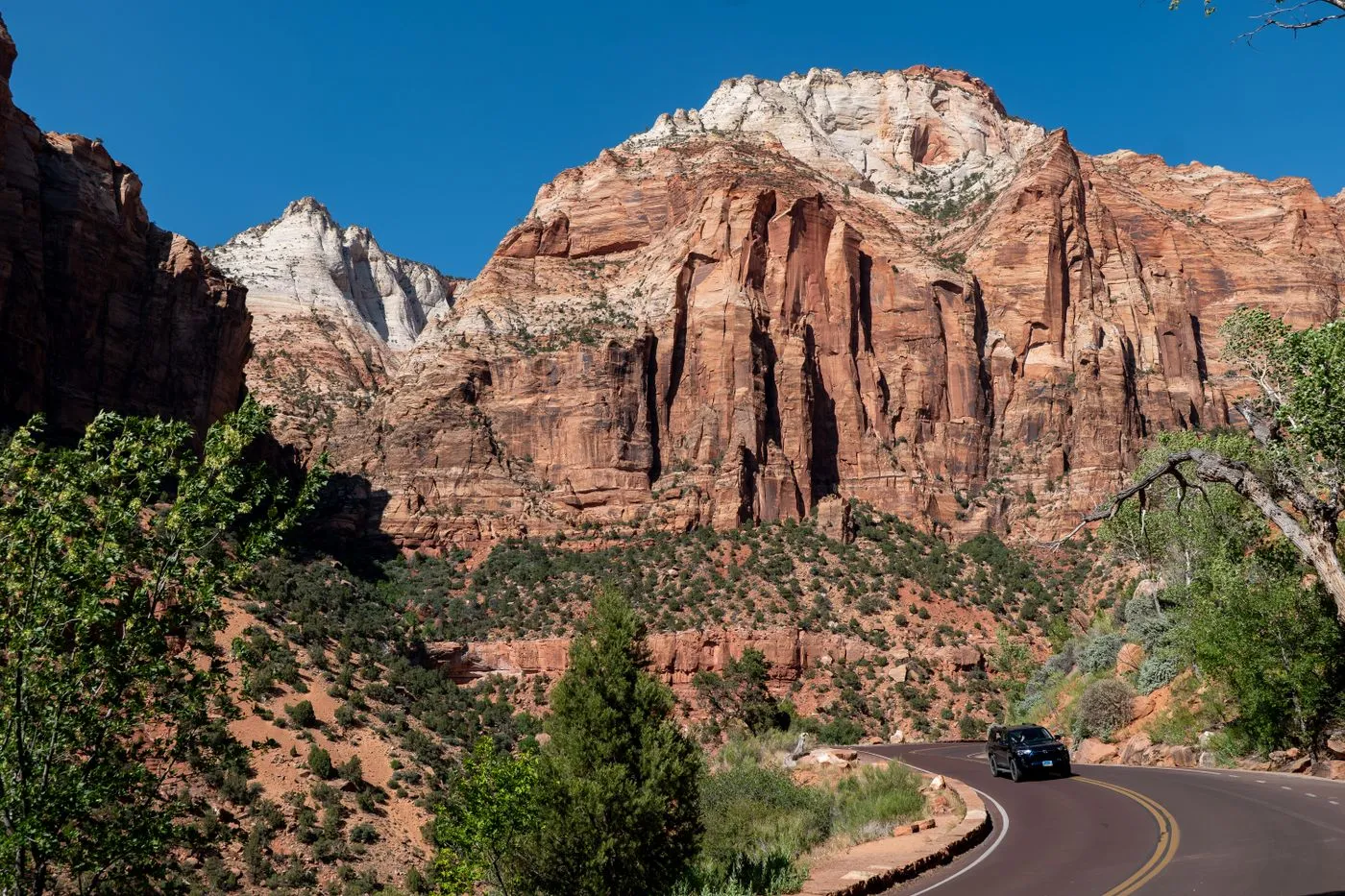
Zion is different from the other parks in the Southwest. Here you do not stand up on the edge and look down, but stand below in the valley and gaze up at mighty rock walls up to eight hundred meters high. Add the green valley floor and the Virgin River winding through it. That makes Zion perhaps the most varied hiking park in the region.
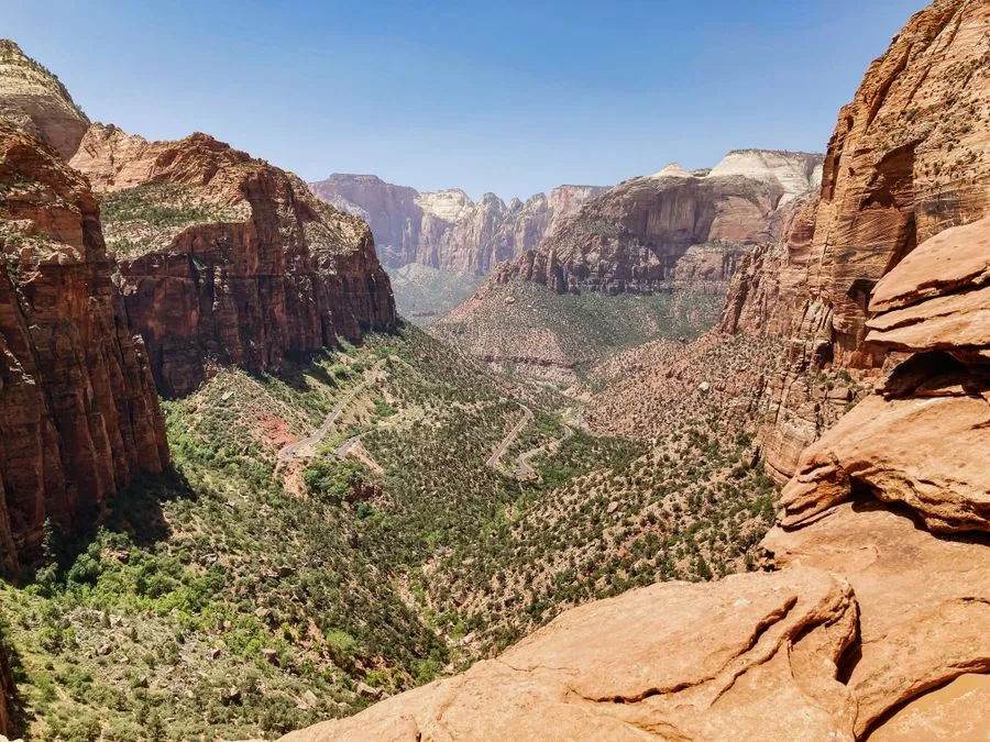
Sheer red walls, a green valley, the river in the middle, that is Zion.

The shuttle bus in the canyon

From roughly March to November the Scenic Drive through the actual Zion Canyon is closed to private cars. Instead you ride the free shuttle bus, which stops at all the trailheads. It sounds restrictive, but it is pleasant: less traffic, no hunting for parking, more calm.

Hiking is the point here

Unlike at the Grand Canyon, where many just step to the edge, Zion lives on setting off on foot. From a leisurely riverside path to an exposed scramble, there is everything. The best-known trails are Angels Landing and the Narrows.

Springdale on the doorstep

Right at the south entrance lies the pretty town of Springdale with hotels, restaurants and gear rental. From there the bus runs to the visitor center, and inside the park itself you do not need a car.

When you should come

Spring and autumn are ideal. High summer is hot and busy, then an early start helps. In winter it is quiet and often mild in the valley, but higher trails can be icy.

Top viewpoints

What you shouldn't miss.

Angels Landing, Zion Nationalpark
1

Angels Landing

The famous, exposed ascent over a narrow ridge with chains. Spectacular and not for weak nerves, at the top you need a permit.

Directions with Google Maps
The Narrows, Zion Nationalpark
2

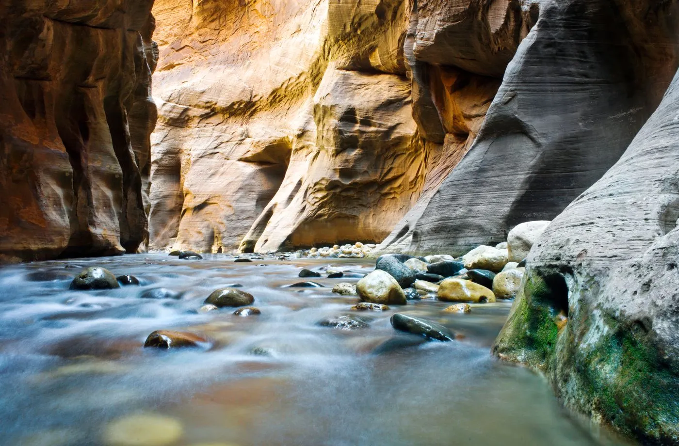
The Narrows

Hiking in the river itself, between high, narrow walls. One of the most unique nature experiences in the USA, gear is available in Springdale.

Directions with Google Maps
Emerald Pools, Zion Nationalpark
3

Emerald Pools

An easy, shaded hike to small waterfalls and green pools. Ideal for families too.

Directions with Google Maps
Canyon Overlook Trail, Zion Nationalpark
4

Canyon Overlook Trail

A short path to a magnificent view over the lower Zion Canyon. Little effort, big effect.

Directions with Google Maps

The big questions from the forum

What was discussed most on USA-TALK.DE, with the community verdict.

Angels Landing, dare it or leave it?

A recurring topic in the forum. The ridge with the chains is exposed and nothing for fear of heights. Those who dare rave about it afterwards. By now you need a permit by lottery.

The Narrows from below or from above?

Most people go upstream from below, as far as they like, without a permit. The whole tour from above is a long day trip with a permit and shuttle.

Is Zion worth it alongside Bryce and the Grand Canyon?

A clear yes in the forum. Zion is scenically completely different, green and vertical instead of wide and open, and for many the most beautiful hiking park of the loop.

If there is only time for one park, Zion or Bryce?

This question divides opinion, both parks have their fans. Anyone who enjoys hiking gets more choice at Zion with Angels Landing, Observation Point and the Narrows, and should invest a full day there. Bryce impresses with colors and hoodoos and often does with a sunrise and a shorter loop. When you really have the choice, several voices lean towards Zion, because a full day there is very rewarding.

Practical tips from the forum

Concrete advice from travellers who were there.

In summer you can only get into Zion Canyon with Zion Lodge, the Emerald Pools and the Narrows by shuttle. The red-paved highway with the tunnel and switchbacks coming from Bryce or Mount Carmel Junction, on the other hand, is open year-round.

from the USA-TALK.DE forum

For the Narrows it's worth having a waterproof bag for about ten dollars, old sneakers that are allowed to get wet, and if needed a simple wooden stick for support. Neoprene socks can help but aren't a must.

from the USA-TALK.DE forum

Better to set aside a full day for Zion so you can do a proper hike like Angels Landing or Observation Point, or wade more extensively into the Narrows. Just driving through the park would be a shame, because then you'd miss the most beautiful things in the northern part.

from the USA-TALK.DE forum

There's plenty to see even if you're not good with heights. The trail to the Emerald Pools and the Riverside Walk to the start of the Narrows are short strolls, and in summer, with kids, wading in the Virgin River or tubing from Springdale is fun, if the water level cooperates.

from the USA-TALK.DE forum

Voices from the community

What travellers experienced on the spot.

Standing below in the valley and looking up at these walls has a completely different force than gazing down into a canyon from above.

from the forum USA-TALK.DE

In Springdale you can hike until you drop and in the evening ride comfortably back with the free shuttle.

from the forum USA-TALK.DE

Wading through the Narrows in the river was the adventure of the whole trip. Rent shoes and a stick on site, then it works.

from the forum USA-TALK.DE

Angels Landing is the big one, if you are fit and free from vertigo, but it takes time, about three hours. It only gets really interesting at the safety chains in the upper part, before that it is a perfectly normal, if strenuous, hike.

from the forum USA-TALK.DE

At over 40°C (104°F) in Zion we gave up in the early afternoon, it was simply too much for us. For tours like Angels Landing you then have to set off early, otherwise the heat becomes torture.

from the forum USA-TALK.DE

As a pure hiking route I found the Canyon Overlook Trail almost more interesting than Angels Landing, because it was nicely simple and went over hill and dale. In 30 to 40 minutes it is done and it lies absolutely on the way, up at the tunnel.

from the forum USA-TALK.DE

In the Narrows you walk less and mostly wade through the water and get pretty cold feet. Again and again you have to linger on dry stretches to warm them up. Anyone who only wants to reach the actual Narrows can manage that there and back in a short day.

from the forum USA-TALK.DE

At Angels Landing there was a veritable mass migration. When we climbed up there ten years ago, we stood at the top with only three or four other couples, that has changed completely.

from the forum USA-TALK.DE

Have you been here? Share your impression

Your experience helps other travellers more than any glossy brochure. Every post is briefly reviewed before publication.

Stay fair and on topic. I approve posts that help others.

Climate through the year

Average temperatures, day and night. Large value °C, small value °F.

13°55°F34°F
Jan
16°61°F37°F
Feb
21°70°F43°F
Mar
26°79°F48°F
Apr
31°88°F14°57°F
May
37°99°F19°66°F
Jun
40°104°F23°73°F
Jul
38°100°F22°72°F
Aug
34°93°F17°63°F
Sep
27°81°F10°50°F
Oct
18°64°F39°F
Nov
12°54°F32°F
Dec

Map with viewpoints

Park, entrances and the best viewpoints at a glance.

Loading the map transfers data (including your IP address) to OpenStreetMap.

Official park map

The official National Park Service map. Zoom and pan.

Map: National Park Service, public domain.

Open map as PDF

Trails at a glance

From a short loop to a full-day hike.

TrailLengthDurationDifficultyNote
Riverside Walk2.2 mi (3.5 km)1 hreasyLevel along the river up to the start of the Narrows. A lovely introduction, doable for everyone.
Emerald Pools3.1 mi (5 km)2 hrseasy to moderateTo the lower, middle and upper pools with small waterfalls.
Angels Landing5.4 mi (8.7 km)4 to 5 hrshardA steep ascent, at the top the famous ridge with chains. A permit by lottery is required.
The Narrows (from below)flexiblefrom 2 hrsmoderateUpstream in the river, as far as you like. Rent gear, watch the weather.
Observation Point8.1 mi (13 km)5 to 6 hrshardHigher and further than Angels Landing, with arguably the best view over the canyon.

Distances and driving times

How far it is to the key places nearby.

FromDistanceDrive time
Bryce Canyon80 mi (130 km)approx. 1.5 hrs
Las Vegas170 mi (270 km)approx. 2.5 hrs
Grand Canyon (North Rim)110 mi (180 km)approx. 2.5 hrs
Page (Antelope Canyon)110 mi (180 km)approx. 2 hrs

Where to stay

Right in the middle of things, or cheaper a bit further out.

Zion Lodge

in the park

The only accommodation right in the canyon, historic and very sought after. Book months in advance.

Springdale

at the south entrance

A pretty town right outside the park, many hotels and restaurants, the bus runs from here into the park.

Hurricane and La Verkin

20 minutes away

Cheaper chain hotels a little outside, easy to reach by car.

Insider tips and common mistakes

What was worth it and what to skip.

Insider tips

  • Take the first bus in the morning, then the popular trails are still empty.
  • Do not forget the Canyon Overlook Trail, a short path, a huge view, right by the tunnel.
  • Stay in Springdale and use the free town bus to the park entrance, that saves hunting for parking.

Common mistakes

  • Wanting to drive into the canyon by car. The Scenic Drive can only be travelled by shuttle bus for most of the year.
  • Hiking the Narrows when there is a risk of thunderstorms. In case of a flash flood warning the trail is closed, that is serious.
  • Underestimating Angels Landing. The ridge is exposed, in the wet or with fear of heights it is better to skip it.

Photos

Click to enlarge.

Zion Nationalpark Zion Nationalpark Zion Nationalpark

Videos

The video loads from YouTube only when you click. No data flows before that.

Zion in One Day, in 4K

Watch on YouTube ↗

Zion, the Big Travel Guide

Watch on YouTube ↗

Zion and Bryce Canyon in 4K

Watch on YouTube ↗

Zion, Beginner's Guide

Watch on YouTube ↗

Frequently asked questions

Do I need a car in the park?

No. In the Zion Canyon only the free shuttle bus runs from about March to November, private cars are banned there. From the town of Springdale you get there comfortably.

How hard is Angels Landing?

Demanding and exposed, the last part leads over a narrow ridge with chains. Nothing for fear of heights, and it requires a permit by lottery.

What are the Narrows?

A hike in the Virgin River itself, between high, narrow rock walls. From below you can go upstream without a permit, gear is available in Springdale.

What does admission cost?

Around 35 USD per vehicle for seven days, or with the America the Beautiful pass. For non-residents an extra charge per person has applied since 2026.

How much time should I plan?

One to two full days. With a big hike like Angels Landing or the Narrows, better two.

Nearby

Easy to combine on a road trip.

Head to head

Hard to decide? This comparison helps.

Share

Last checked . I check changeable details like entrance fees once a year.